
Medbourne History in Photographs
Scroll down the page for a varied collection of interesting old photographs.

Medbourne's windmill used to stand on the corner of Slawston Road.

Below 4 Springbank (at 5 Springbank?) stood a cottage, now demolished.

The same cottage as above, taken in 1938. The thatch has gone, replaced by a corrugated roof and some weatherboards.

Not all of the cottage above disappeared. Look closely at the stonework in the garden wall of 4 Springbank and the step up to the gate.

Tobbit's Garage was at what is now 4 Springbank. Nice car!

Tobbit's also owned a bus, shown here in 1928.

The current Village Shop and Post Office in Springbank used to be a butcher's shop and grocer; the Post Office was two doors away on the corner of Main Street. The shop owner was William Warner, seen here on the step; the shop was later inherited by his son Arthur.

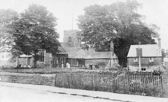
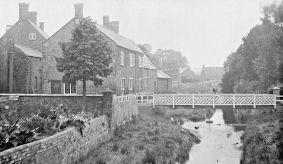
The buildings at the bottom of Springbank are shown here around 1900. Of these only the Old Queen House still stands - set back at the centre of the group.
There used to be cottages in the grounds of St. Giles, since demolished.
A closer view of one of the cottages in the churchyard taken from an old postcard. There's a gate in the fence in the foreground not there in the previous photo.

In 1916, after the cottages above were demolished, a dedication service was held. Note that this is mostly women - the men were away at the First World War.
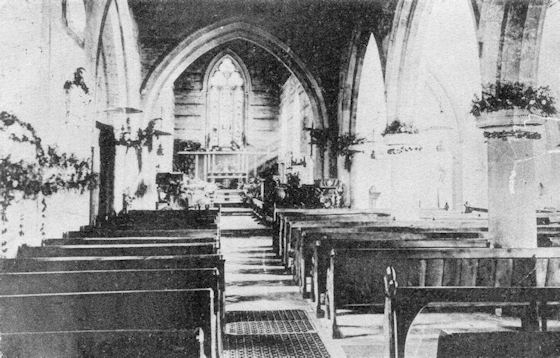
St. Giles interior from a postcard dated 1905. It hasn't changed much.
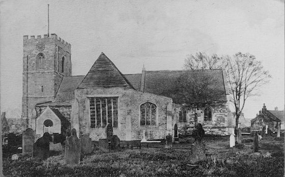
From a postcard with an Edward 7th stamp (between 1901 and 1911) the South East facade of the church is very different from the view below taken 10 to 20 years later. The gable end looks decrepit and it's not surprising it was rebuilt.

St. Giles' church in the 1920s showing the South East facade as rebuilt in 1912.
See also The History of St. Giles' Church.
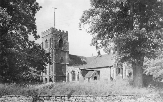
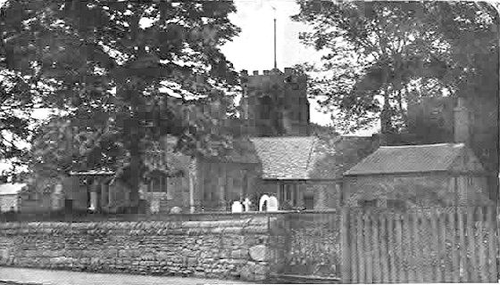
Another postcard view of St. Giles. Date unknown. The graveyard is cropped much more neatly these days and the tree on the right has now gone due to disease.

Across Main Street from St. Giles is the Rectory, shown here when it was still the Rector's residence.
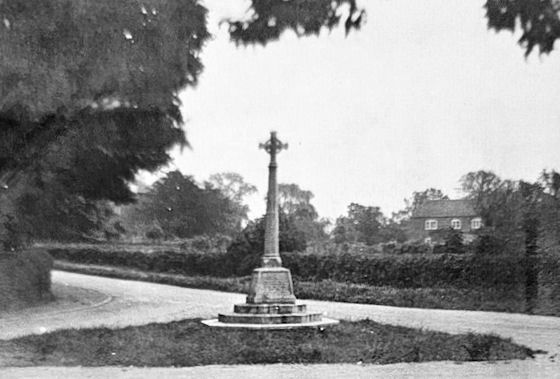
Prominent on the corner of Main Street and Manor Road stands the War Memorial. This picture is taken from an old postcard, date unknown, but obviously post July 1920 when the War memorial was unveiled. See The War Memorial and the Men it Commemorates.

An early photo of the Packhorse Bridge. In those days it was more necessary as the ford was not piped under the road as we have now.

Another view of the Packhorse Bridge in 1900. There are some stepping stones on the right-hand side of the road.
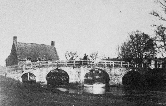
Another early view of the Packhorse Bridge with The Shieling behind. Thought to date from the early 20th century, the clothes of the people on the bridge give a clue.

A postcard showing St. Giles' church and the Pack Horse Bridge, date unknown.

A familiar sight even today with the Packhorse Bridge, St. Giles' church and The Shieling. The clue to the age of this old postcard lies in the costumes of the children on the bridge.

The Packhorse Bridge with the Shieling behind - 1920s.

Another postcard view of Medbourne's most photographed scene. Date unknown.
This is also a postcard showing Manor Farm and the Ford, date unknown. Note that the farmhouse is rendered; the rendering was removed to reveal the stone building we are familiar with today.

A view along Hallaton Road looking towards St. Giles' church taken in the early 1900s.

A wider view of the village - this is an old postcard photograph taken, possibly, from the Slawston Road.

An early photograph of 7 Waterfall Way, date unknown.

There was another ford directly in front of the Nevill Arms, where the waterfall now flows.

This is the same ford taken from the Nevill Arms side.
Another view of the old footbridge alongside the ford by the Nevill Arms.

The Village School and the schoolmaster's house at 10 Main Street. Possibly 1920s.

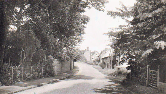
The junction of Main Street and Hallaton Road.
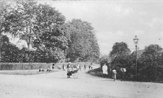
This postcard is entitled Kennel Lane, Medbourne, which we now know as Manor Road. The Fernie hunt kennels were at the top of Kennel Lane and have since been converted to residential accommodation. This photo pre-dates 1920 when the War memorial was erected on the triangle in the left foreground.

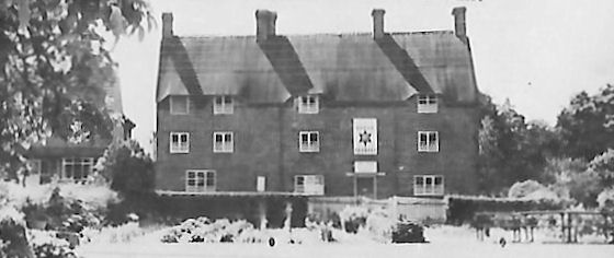
Early photo of the Horse and Trumpet. Note the corrugated roof - a wartime expedience. Eady and Dulley used to be the local Market Harborough brewery.

Next door to the Horse and Trumpet stood this cottage. The site now occupied by a modern house.

Another view of the Horse and Trumpet and the thatched cottage next door. Also seen is a variety of outbuildings behind these two.

The Horse and Trumpet again, taken from the North East side. The cottage shown above has now gone.
This view of the Horse and Trumpet dates from the 1950s.
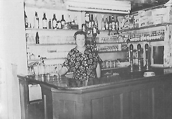
In the 1950s the landlords of the Horse and Trumpet were Mr. and Mrs. Fred Price. Mrs. Price is shown here behind the bar.

This cottage stood in the alley next to the Horse and Trumpet.

A very early photo of Main Street. The forge in the foreground, now called The Old Forge, with the Crown public house behind, now called Crown House.

A similar but different photograph of Main Street taken from a postcard.

Another postcard showing a similar view of Main Street.
Yet another postcard showing this to be a favourite view of the village.

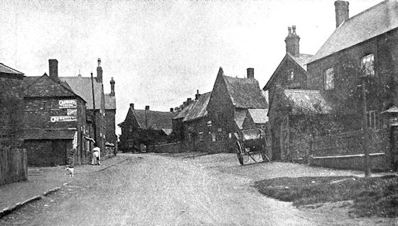
A view of Main Street and Springbank. The village shop and Post Office is on the corner with the butcher's shop occupying the location of the current shop. Tobbit's Garage is shown and there's a bus coming out of the entrance.

A photo taken in the 1950s which more clearly shows the Post Office on the corner of Main Street, two doors away from its current location.

Just above the village shop on Main Street stood this pair of buildings; they were used as storerooms for the shop. Demolished in the 1960s the site is now a garden. The white house at this location was behind these buildings.
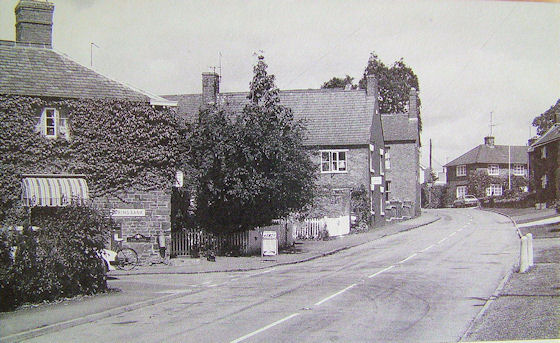
The corner of Springbank and Main Street. This is post 1960s as the old buldings in the photo above have gone. The Post Office is now covered in a climbing plant and the vehicles look like 1970s vintage or maybe later.

An early view of the forge taken pre 1914. Characters in the foreground are Sir Bache Cunard, his Stud Groom and blacksmiths Eli and Len Barlow.

A closer view of the forge whilst still active - complete with a horse getting new shoes. The Crown has become a dwelling.

The blacksmiths at work at the forge. It is assumed that this picture shows Eli and Len Barlow but the other two are unknown.

Slight further North on Main Street, number 27, Stone Cottage, taken in 1904.

The building still standing at 35 Main Street used to be the Co-op.

Further along Main Street in 1911 - the parade is for the coronation of King George V. On the left are numbers 48 and 50 Main St.

A better view of 50 Main Street looking South with numbers 44 to 48 just beyond. Date unknown.

This is the Station Master's House at the top of Main Street - its address is actually Uppingham Road. The date is 1939 so the station was closed by this time.
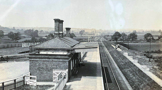
This is Medbourne Station. It was destroyed by fire in 1916. The track remained until the 1960s when it was finally lifted. The site is now covered by an extensive set of horse stables.

An early photo of Manor Road which was previously known as Kennel Lane.
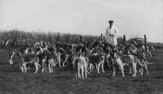
Here are the occupants of the kennels when the Fernie Hunt was domiciled in Medbourne.

These cottages stood on the left-hand side of Old Holt Road as you look up the hill.
This old postcard was entitled Nevill Holt Road.

The Fernie Stables in Ashley Road now converted to dwellings.